


Territorial & Freely Associated Oral Health Programs
Republic of the Marshall Islands
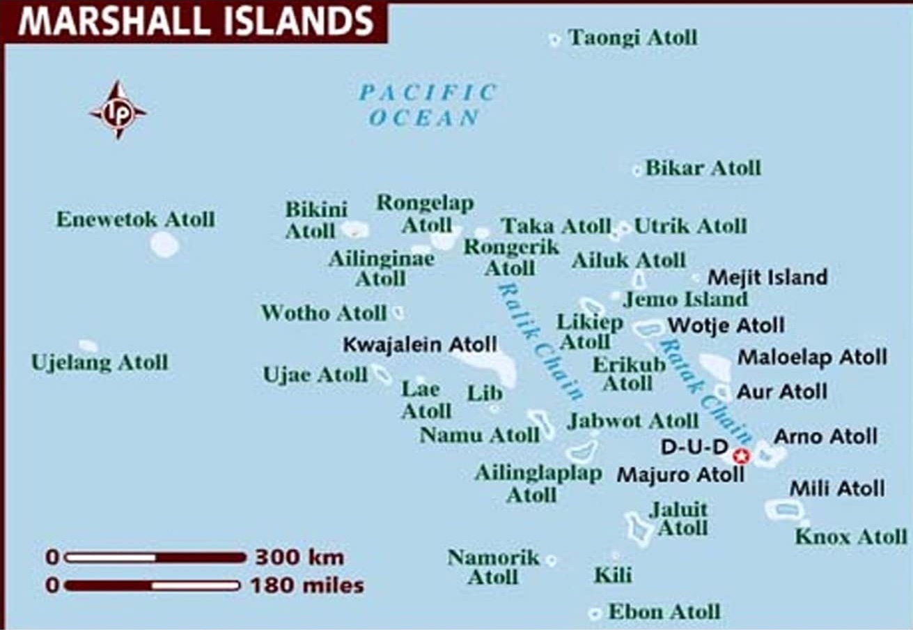
Geography: Marshall Islands, also known as the Republic of the Marshall Islands (RMI), lies east of the FSM and 2,500 miles west of Hawai`i. There are 29 atolls with 1,225 islets, totaling only 70 square miles of land, but scattered across 750,000 square miles of ocean. The largest atoll (Kwajalein) is a US military base (Ronald Reagan Missile Testing Program). Some parts of the atoll are prohibited to Marshallese occupation. More than 13,000 people live on Ebeye (an island in the Kwajelein Atoll), also referred to as the "bedroom" community for Marshallese workers commuting by boat to service jobs on the nearby US military base of Kwajalein. At roughly one sixth of a square mile, Ebeye is one of the most densely populated places globally with a 36% unemployment rate, and with more than 38% of its population under the age of 15 yrs.
Health Services: RMI has one major hospital, Majuro Hospital, and a Community Health Center in Ebeye. Also, there are 56 health care centers and dispensaries in the outer atolls and islands.
Demography: Half the population lives on Majuro Atoll, the nation's capital, which sits on a thin ribbon of land, sometimes less than 50 yards wide, and encompassing the deep Majuro Lagoon. In the 1950s, the RMI was the site for US nuclear weapons testing, with Bikini, Rongelap and Enewetak Atolls still unsafe for human habitation due to unsafe radiation levels in the ground soil. The per capita income is $3,400, and 70% of its national revenue is in the form of US grants/Compact funds. The RMI ethnicity is predominantly Micronesian, and the languages spoken are Marshallese and English. The literacy rate is 93.7%. With a 36% unemployment rate in RMI's most densely populated island, and a per capita income of $3,400, 80% of RMI is below poverty level.
Sociocultural determinants of health: At 70 sq. miles of land spread across 750,000 sq. miles of ocean, RMI faces the same problems as FSM in that most of the population is unable to seek and receive proper health care. Transportation includes a few privately-owned vehicles, infrequent inter-island ships, and 35 airports of which only 5 are usable. High poverty levels, distance between islands, shortage or maldistribution of health providers and services, and lack of transportation limit the ability of the people to seek and/or receive proper health care.
*Information provided by PIHOA in 2019 and adapted for the ASTDD Needs Assessment Project and this webpage